Valle de Calamuchita:
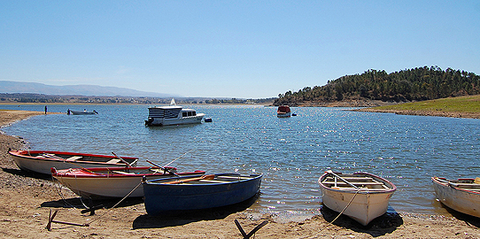
Lago Los Molinos
Los Molinos river is limited to the west by La Pampa and Cumbre de Achala to the eastby Sierras Chicas to the north by La serranita and Cordón de Santiago, which separates Valle de Punilla from santa Ana,to the south by Achala Hill.
It is formed by San pedro de los espinillos, del medio and los rerates rivers. It is in a rural area with strong sleeps which have led the erotion.
Los molinos dam gathers the flow of a 980 km2 catchment basin.
Its wall is 60 m high and 240 m long. The reservoir has a surface area of 24.5 km2 and a volume of 399 million m3, the maximum depth of the water is 57m.
The dam was built between 1948 and 1953, and its primary goals are the regulation of the flow of the river and the production of hydroelectricity. Los molinos I power plant generates 148 mw for the Central region of Argentine Interconnection System. The reservoir is bordered by Provintial Route Nº 5. It is employed for silverside fishing, swimming, water skiing and sailing.
It is surrended by a wonderful flora and fauna.
The vegetation is represented by steps, mountain forest ( molle,coconut,slashand gorse) shrubland ( rosemary and tiger beard ) tall pastyre( grasses).
The fauna is composed by skimks, foxes,weasels,vizcachas and hares.
There are also suprising herons, eagles, vultures, biguas, calenders and so on.
According to the season you may find lizards, yararás and iguanas. For those, fishing lovers there are silversides, catfish and trouts. The main activity here is the tourism.